

Class on November 21 2017
Rob started off with an overview of useful features of Google Earth software.
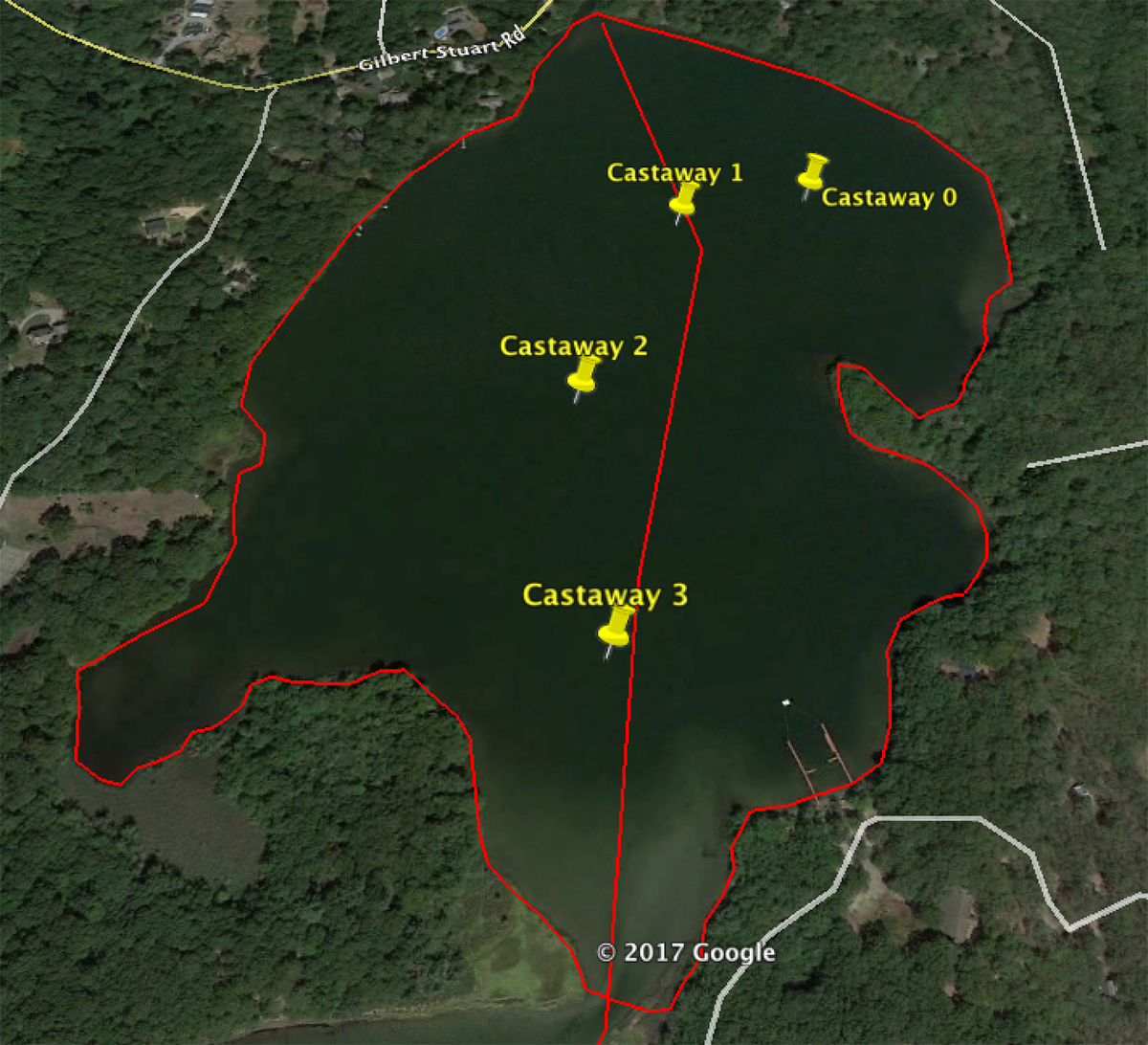
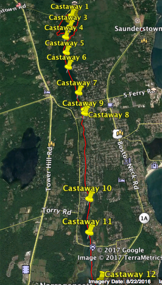
He demonstrated how to create a placemark based on latitude and longitude. He demonstrated how to use the ruler tool to measure a path and polygon (area).
Then we looked at lower pond v. upper pond salinity and temperature and discussed movement of various parcels during ebb tide, flood tide, and wind. We got up and represented different parcels of water and found our place in stratification:
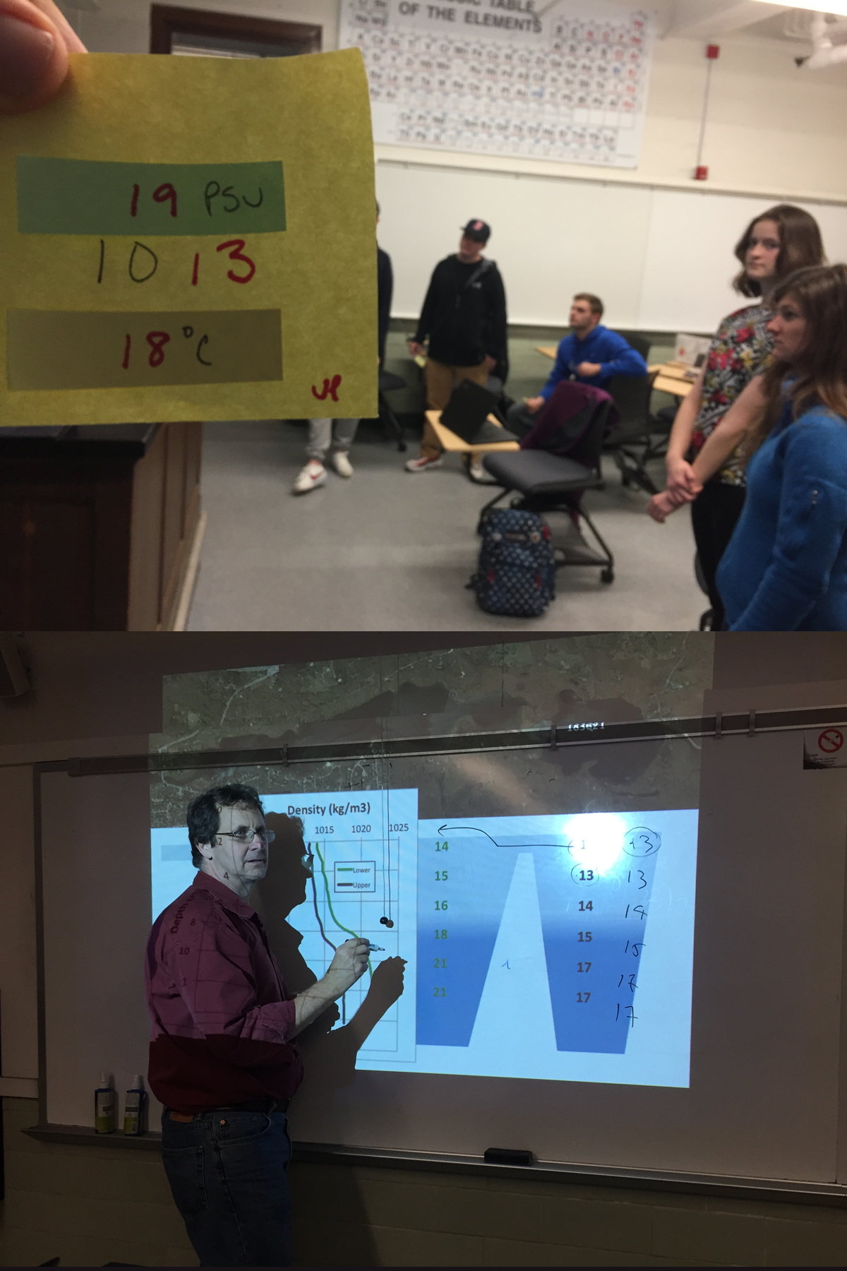
Water density can be calculated from salinity and temperature. 19 PSU and 18 °C = 13.062 (lowercase rho symbol), which is designated in the red 13 on the sticky note above.
We then chose final project topics from the discussions of the previous three classes for each student (and put them in teams for collaboration):
Selfish: 1) Jacop, Josh, Jasmine 2) Lexi, Tayler
Sill removed: 3) Katie, Mike, Gavin
Middlebridge widened: 4) Rose, Emma, and Rachel
He demonstrated how to create a placemark based on latitude and longitude. He demonstrated how to use the ruler tool to measure a path and polygon (area).
Then we looked at lower pond v. upper pond salinity and temperature and discussed movement of various parcels during ebb tide, flood tide, and wind. We got up and represented different parcels of water and found our place in stratification:
Water density can be calculated from salinity and temperature. 19 PSU and 18 °C = 13.062 (lowercase rho symbol), which is designated in the red 13 on the sticky note above.
We then chose final project topics from the discussions of the previous three classes for each student (and put them in teams for collaboration):
Selfish: 1) Jacop, Josh, Jasmine 2) Lexi, Tayler
Sill removed: 3) Katie, Mike, Gavin
Middlebridge widened: 4) Rose, Emma, and Rachel